by Joseph Toone
About eight miles south of town, beyond the dam and along the banks of the Rio Laja, is the village of La Huerta (the Orchard). It is reached along the bed of an abandoned railroad track that travels through a quarter-mile long, 15 foot-wide tunnel dug in 1903. The ceiling towers above you formerly allowing the steam from the then steam engines to escape.
Along the dirt road to La Huerta you will pass mules hauling the bamboo that grows abundantly alongside the river for construction projects or used to make reed baskets. There is only one point to cross the river. Well, that’s not technically true. There is only one point to cross the river by bridge. You can also cross the river using a zip-line, one-person, hand-propelled trolley contraption, assuming you are feeling brave and possess big biceps. Getting across the river this way is hard work and, as my pal soon realized, not particularly rewarding, as there isn’t much to do on the other side the river at that point.

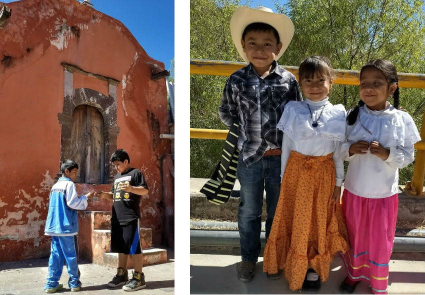
My most recent foray occurred on the Friday before Revolution Day. Never have I seen the village so active. Children were dressed as revolutionary heroes and enjoying a fiesta-filled atmosphere. Two angels that were chatting me up in front of the oldest chapel in town immediately went back to boy business, lighting fireworks after we solved all the world's problems.
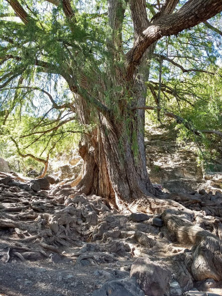
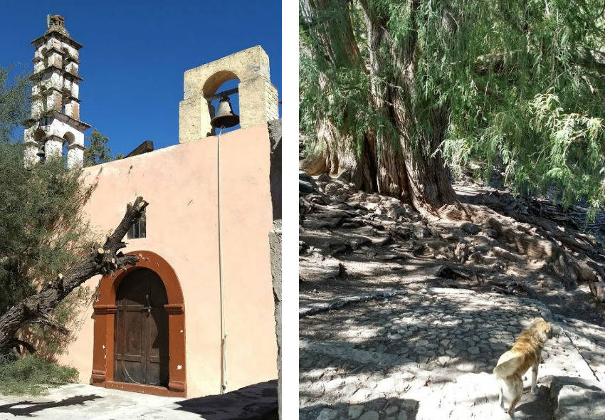
Alongside this old chapel, is a path, lined with livestock, dogs and fowl of all types, leading to the oldest tree in the area. It is around 500 years old. The tree is called Sabino, indigenous for “old man of the water”. It grew and grows nicely in this spot by a spring of water as a Bald Cypress tends to. If you don’t trip over the complex root system it takes about 20 people to circle this, the national tree of Mexico’s base.
This visit I was fortunate enough to be visited by a very friendly dog with the stripes of a tiger. I wanted to take her home and name her "Tiger" both for her pelt and for my affinity with the Brady Bunch dog, Tiger.
After your visit you can go right down the main dirt road, and see the ancient chapel to the Sacred Cross behind the grade school with a lovely old spire and a beautiful calvario that is still in use. Calvarios contain a cross and where one places flowers to your ancestors before entering the church. After crossing the railroad tracks you’ll see the back stone wall to the large winery/housing complex that leads you back to the highway and San Miguel via the town of Los Remedios (Mary of Good Help). Mary of Good Help was a Barbie-sized image of Mary that appeared in an early battle the Spanish won. She became the mascot for the Spanish side of the Revolution for Independence. The Mexicans had Guadalupe. As you leave town note that despite the town being named Los Remedios after her, she is placed on the back side of sign welcoming folks to town while Guadalupe has the more prestigious, forward facing image.
As you come back into the town you’ll cross the mountain that the indigenous considered the center (North-South and East-West) of the Americas and where our souls go to enter the afterlife. Overall, that's quite a momentous journey.
**************

Joseph Toone is Amazon's bestselling author of the San Miguel de Allende Secrets series of books and TripAdvisor's best rated historical walking tour guide. For more information contact toone.joseph@yahoo.com or visit History and Culture Walking Tours or JosephTooneTours.com, also on FaceBook.
You must register and log in to write a comment.
Please use the "login" link at the top (right) of the page.
|